Topographical services are a complex of engineering and geodetic works that provide detailed, accurate and three-dimensional data collection of a specific area of the earth’s surface and their graphical representation. This is a fundamental initial stage of any construction, planning or land registration process.
Topographical services go beyond simple measurements, they create an accurate digital model of the territory, without which it is impossible to reliably plan engineering projects.


This is the heart of the service. As a result of topographic surveying work, a topographic plan (topo-map) is created on a large scale (most often 1:500). This document details:
Relief: Contour lines (isohyphs) show the height difference and slope of the territory.
Existing objects: buildings, fences, roads, rivers, green cover.
Underground and above-ground communications: power lines, gas pipelines, water pipelines, sewage networks and wells.
Staking involves transferring the exact geodetic coordinates of the boundaries (corners) of a plot registered in a project or in a public registry to the real territory and physically marking them. This service is vital for:
Cadastral drawings are prepared based on topographic data, which are necessary for registration in the public register of real estate, as well as for the preparation of schematic plans for the division and unification of plots.
Topographic services can be performed as part of:
Interior Measurements: Accurate measurement of interior spaces, openings, and facades of buildings.
Aerial Surveying (Drone Topography): Creation of fast and high-precision orthophotos and digital terrain models of large areas.
An accurate topographic plan is the best way to manage risks:
Conflict prevention: Precisely defined boundaries will avoid disputes with neighbors and local governments.
Project efficiency: Accurate data on terrain, communications, and landmarks allows architects and engineers to create an optimal, cost-effective project.
Legal legitimacy: All documentation required by the Public Registry must be based on high-precision topographic measurements performed by a certified surveyor.
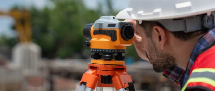
Topographic services are performed using modern equipment (RTK GPS, total stations) and require the involvement of a certified specialist.
We offer:
Copyright © 2025